Established
A substantial earthwork survived into the twentieth century and was sufficiently distinct to survey.
Historical topography
The physical earthwork is the strongest element in the Connowedit case. Its existence is secure; its date, builders, original form and historical name are not.
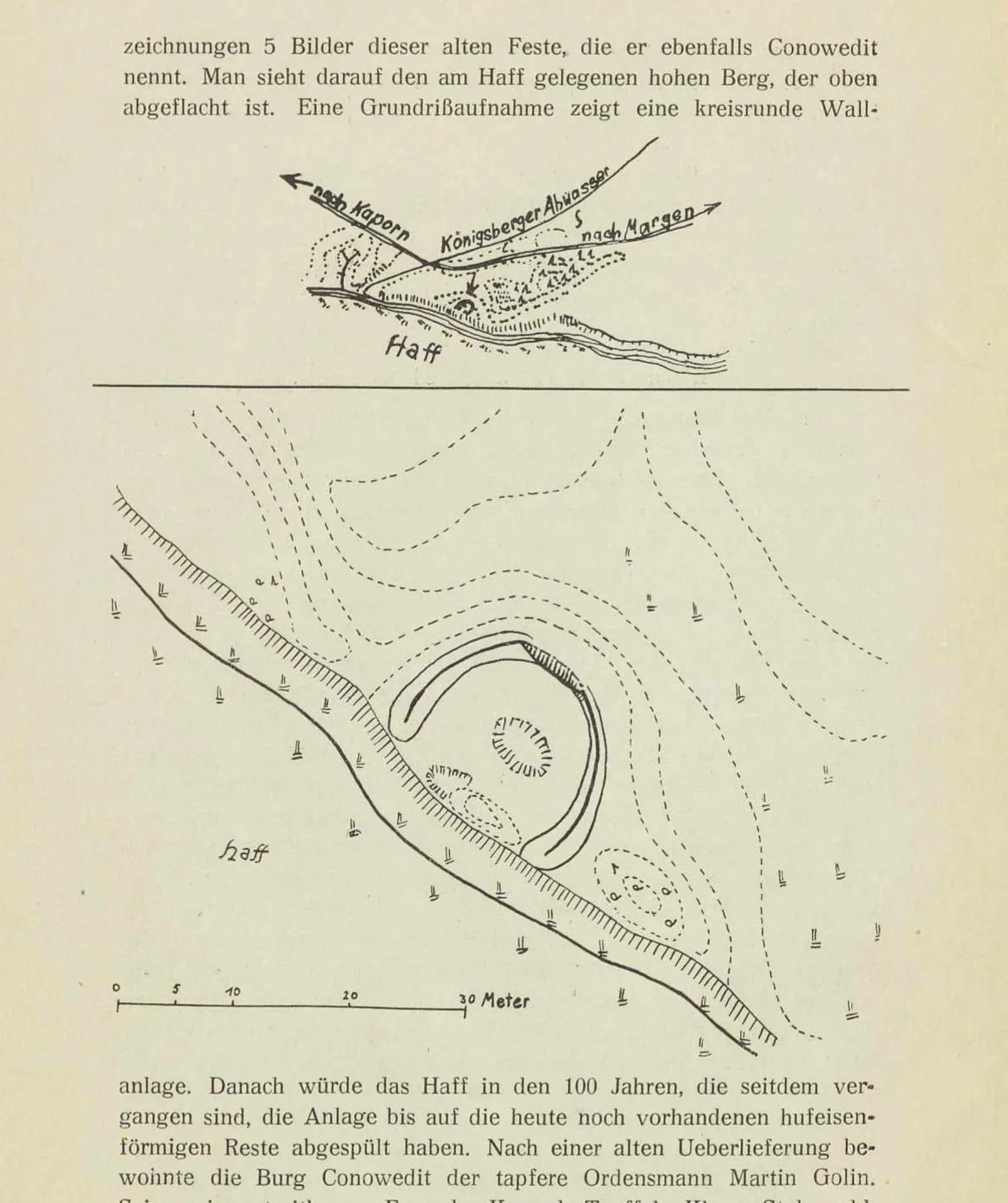
Hans Crome records a horseshoe-shaped rampart west of Margen, open towards the Haff. He reports that sand extraction had destroyed part of the site and that further removal was eventually stopped.
His language is careful: the banks stood where, “according to tradition”, old Conowedit had been. The survey and the identification are not the same statement.
A substantial earthwork survived into the twentieth century and was sufficiently distinct to survey.
Its age, cultural attribution, use by the Teutonic Order or identity with Dusburg’s castle.
Crome says that Lieutenant Johann Michael Guise recorded the place about a century earlier in five images. These included a ground plan showing a circular enclosure and views of a high, flat-topped hill by the Haff.
An enquiry has been sent to the Museum für Vor- und Frühgeschichte / Prussia-Fundarchiv in Berlin for the five sheets, Crome’s explanatory slips, possible photographs of lost material and modern archive references.
Eighteenth-century description
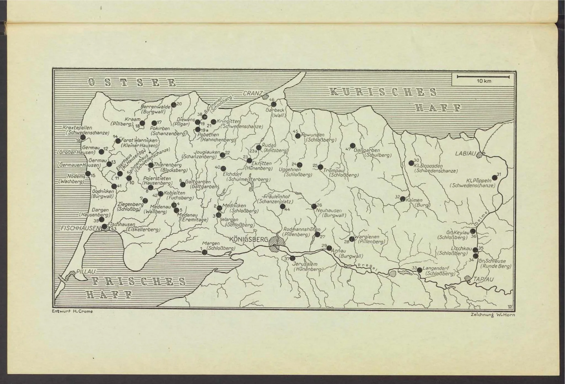
Jester places Connowedit between Caporn and Maargen, roughly 300 paces from Maargen, upon a high hill projecting into the Haff “like a tongue”. He says storms and ice had already destroyed much of it, that foundations could be seen in the water, and that urns, rings, pins and other objects had been found nearby.
Jester is valuable as an eighteenth-century observer, but his physical description is mixed with etymology, legend and historical reconstruction. The projecting landform is not clearly preserved on the twentieth-century Messtischblatt states examined so far. Erosion may explain that difference, but it has not been independently demonstrated.
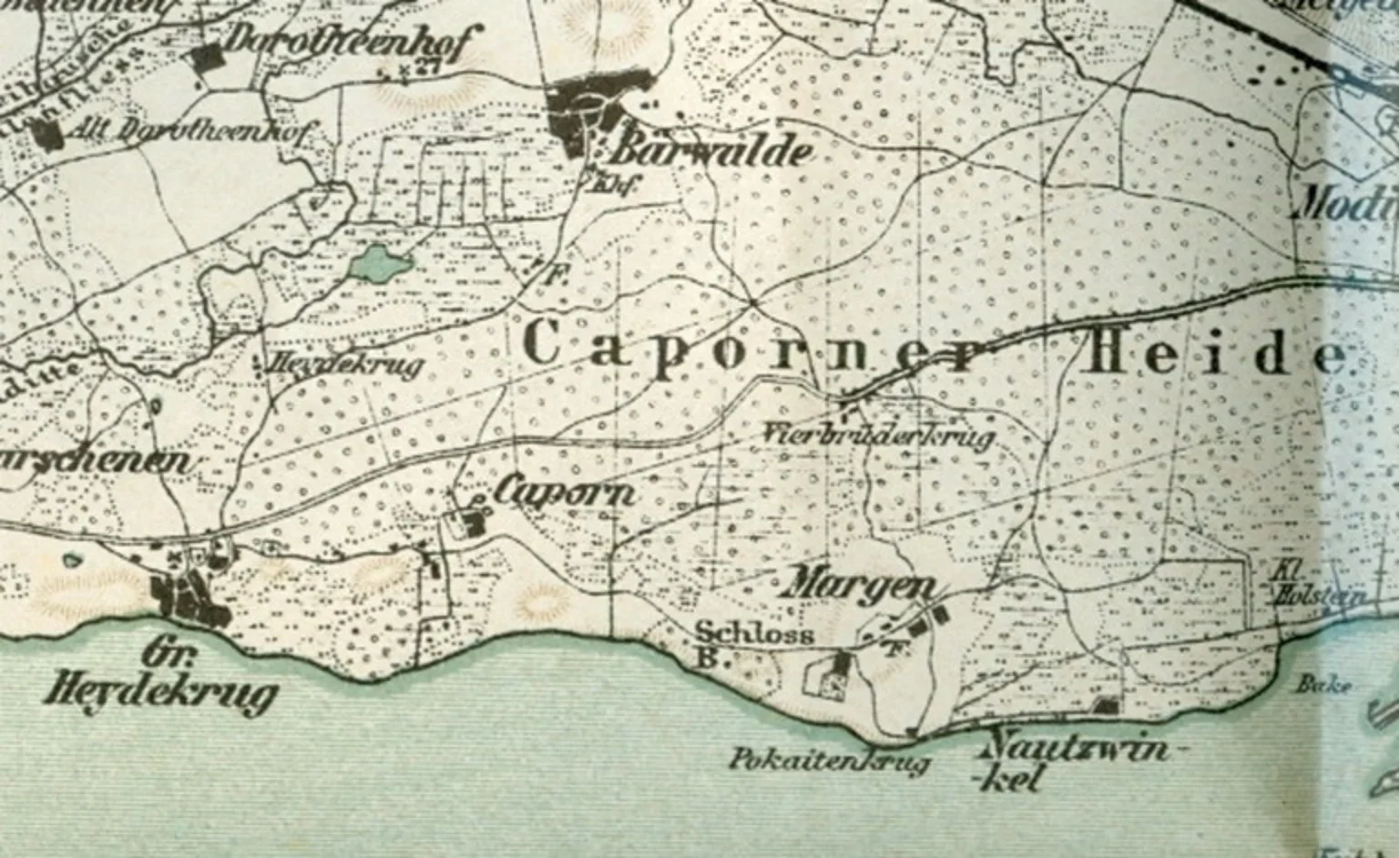
The small-scale map is important because it distinguishes the coastal Schlossberg from Margen itself and from the Vierbrüderkrug in the Caporner Heide. It does not label the earthwork Conowedit, but it confirms that the hill was recognised cartographically as a castle hill.
Pokaiten and Pokaitenkrug also belong to this Haff-side landscape. Their documented connections with fishing, a Krug and winter transport illuminate the ordinary working environment around the site, but they do not bear directly on its medieval identification.
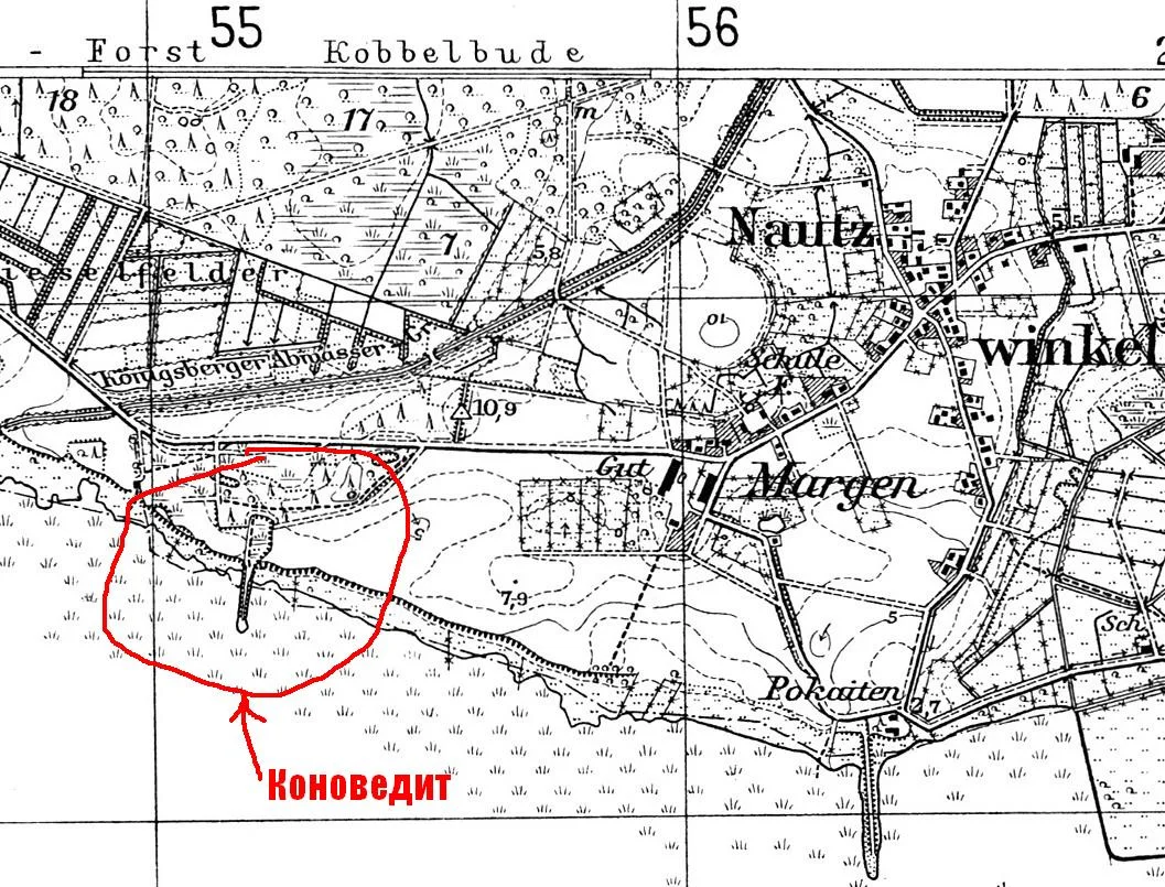
The forum crop is unmistakably based on Messtischblatt 1387/228, Brandenburg (Frisches Haff), at 1:25,000: grid lines, spot heights, roads, fields, the Königsberg wastewater channel, Margen and Pokaiten match the Herder Institute copies.
It is nevertheless not identical to the available 1937a and 1937b scans. The forum version depicts the supposed Conowedit area with a more definite curved earthwork and a straight embanked approach to the Haff. Those details are absent or differently represented in the Herder copies. It may therefore reproduce another correction or wartime printing state.
The narrow projection at Pokaiten is probably a constructed jetty or landing stage. The equivalent-looking feature at the marked Conowedit site should not be treated as Jester’s natural “tongue of land”.
Modern field evidence
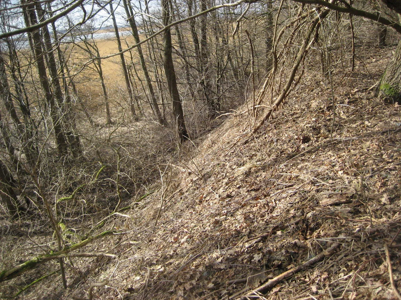
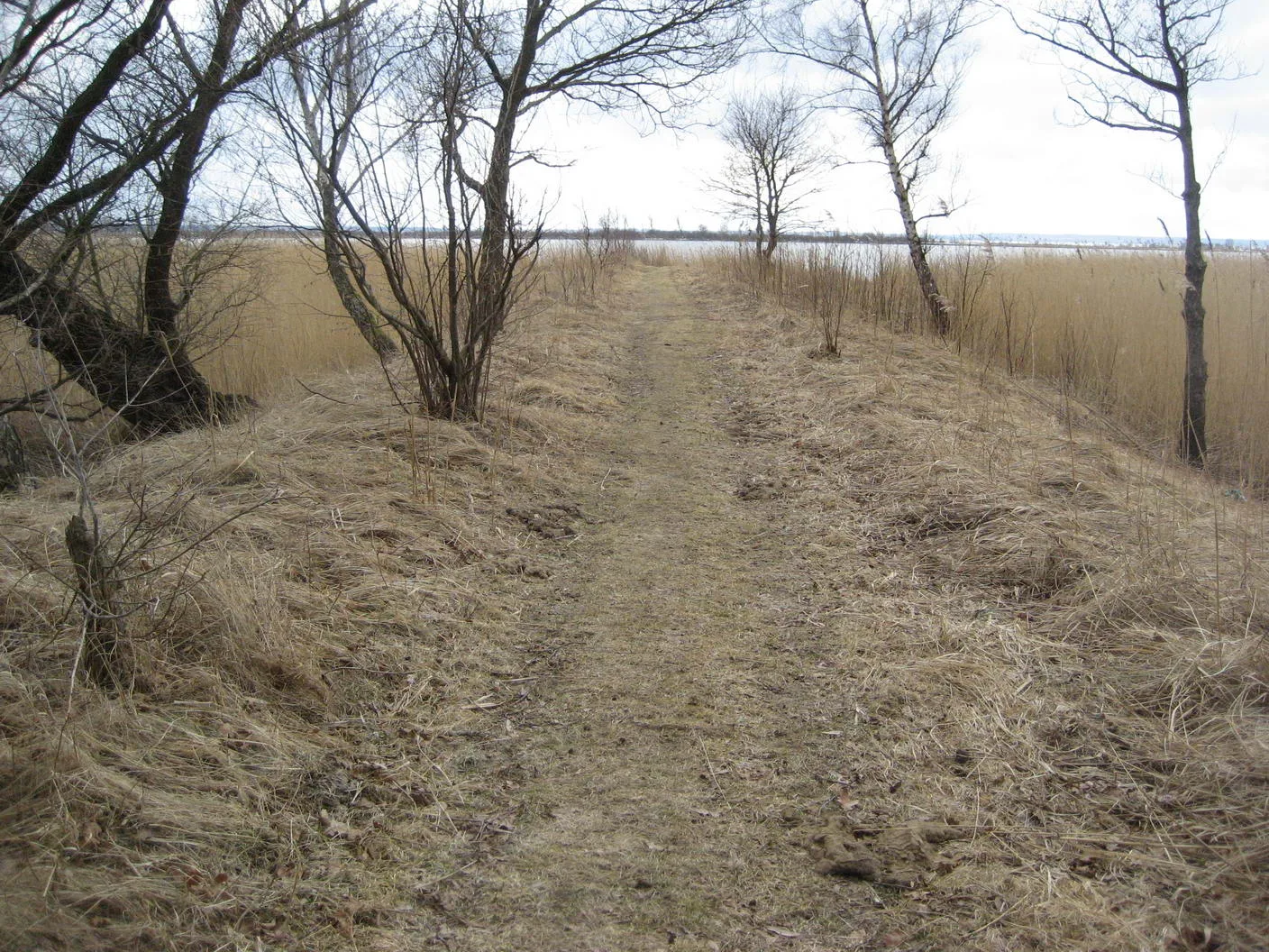
The two photographs are by Vasiliy and were taken during the 2011 field visit. On 27 August 2026 he kindly gave permission for their reuse, asking only that the original forum thread be linked.
The best current provisional coordinate is approximately 54.690833° N, 20.300278° E, with an uncertainty of roughly 100–200 metres until the historical maps, photographs and surviving banks are aligned more precisely.
The old Königsberg wastewater channel is the most useful fixed landmark. The forum visitors approached through modern allotments, crossed the channel and continued towards the embanked shore route and the wooded earthworks.